Cyclades seen from Space

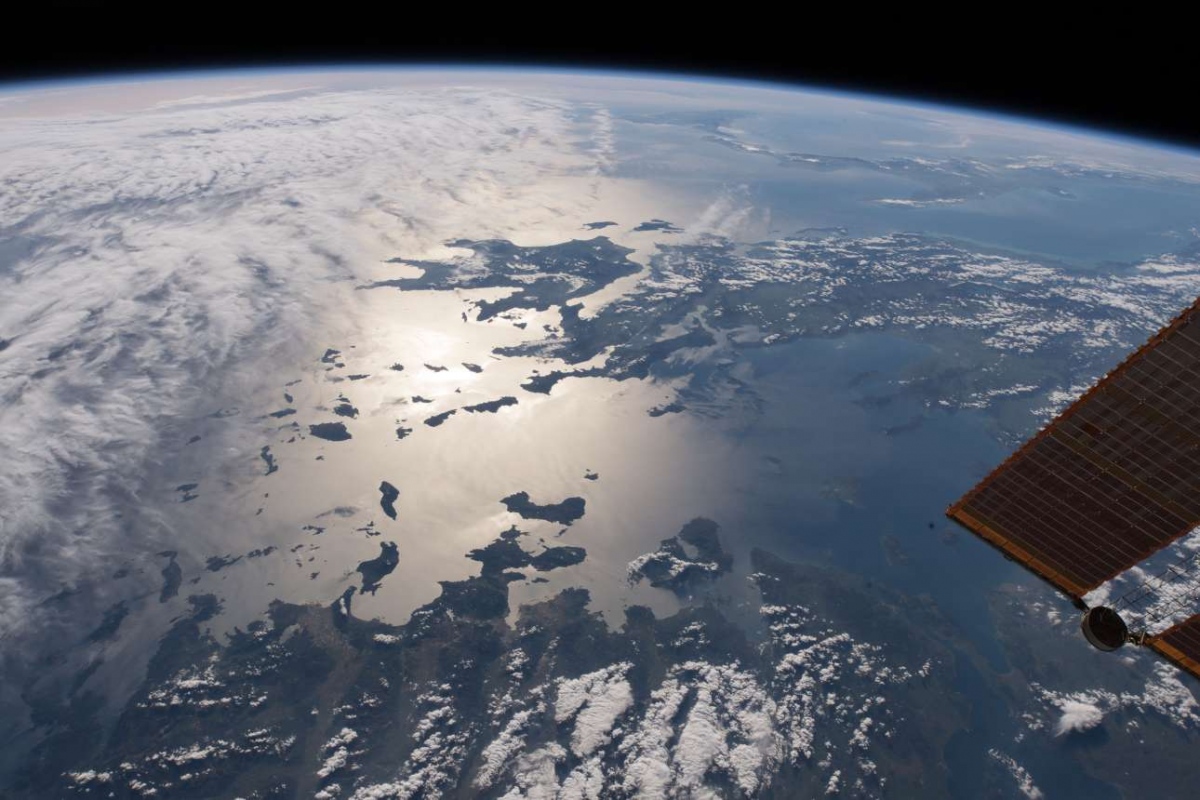
The ISS-9 space station crew took a high-resolution photograph of the Aegean and Ionian islands, with the Cycladic islands standing out, allowing for spectacular observations on the geomorphology and location of the islands. The sunshine in the Aegean Sea highlights the Greek islands. The photograph of the Aegean and the Ionian Sea from the International Space Station, published by NASA, has prompted the interest of social media users and has already become viral within a few hours, highlighting two beloved elements: the heaping light of Greece and the Aegean Sea.
In the picture, one can distinguish the clarity of the Aegean islands and the Peloponnese, while the mainland of Greece is blurred, from Attica to Halkidiki, which stands out at the right end of the photo, slightly to the left of the part of the space station shown in the photo. The intense sunshine and the impressive light that is the most attractive feature of the Aegean Sea is evident in the photo taken from space, while the only island that does not stand apart due to clouds is Crete, the largest of the islands.

What makes this photo special and why is it that it became viral the moment it appeared? The answer is simple: it’s the distinct beauty of the Aegean with both its small and big islands that decorate the Mediterranean which make us Greeks proud to be born in such a beautiful corner of the planet Earth. Looking at the Aegean Sea from space, we are fascinated by the sun’s reflection on the water and the silhouettes of the Cycladic islands that make for a beautiful brown colored mosaic. The fact is that anyone who has seen Greece will always carry the memory of the miracle of its light in his heart, the dazzling glow, the vibrant colors, and its glowing brightness that bathes every spot.
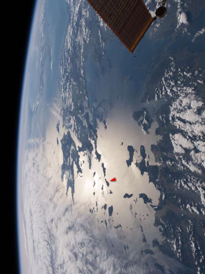
Those who can tell the Aegean islands apart are able to distinguish the beautiful island of Tinos (red arrow), which dominates the central Aegean and the Cyclades. The Cyclades are said to have been named after the geographical circular formation they make around the sacred island of Delos.
In Crew Earth Observations (CEO), the staff of the International Space Station (ISS) photograph the Earth using digital handheld cameras from their unique viewpoint located 200 miles above the surface. The photographs depict the changes of light over time as well as changes caused by weather phenomena that seem to move at a greater speed due to the distance involved. The crew’s greater emphasis is on tracing all the important elements that will help us comprehend our planet from a better perspective. Earth has been photographed from space since the early Mercury missions beginning in 1961. The images taken from the ISS ensure this record remains unbroken.
